
GIS Florida Tree Mapping
Florida tree Mapping
GIS Mapping Branches Out to Streamline Tree Trimming
Visualizing the Urban Forest
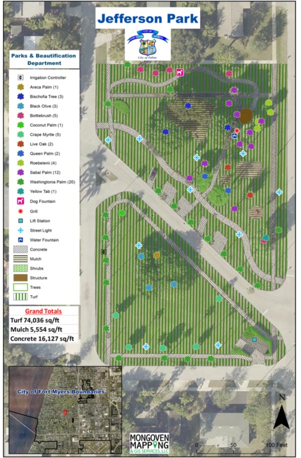
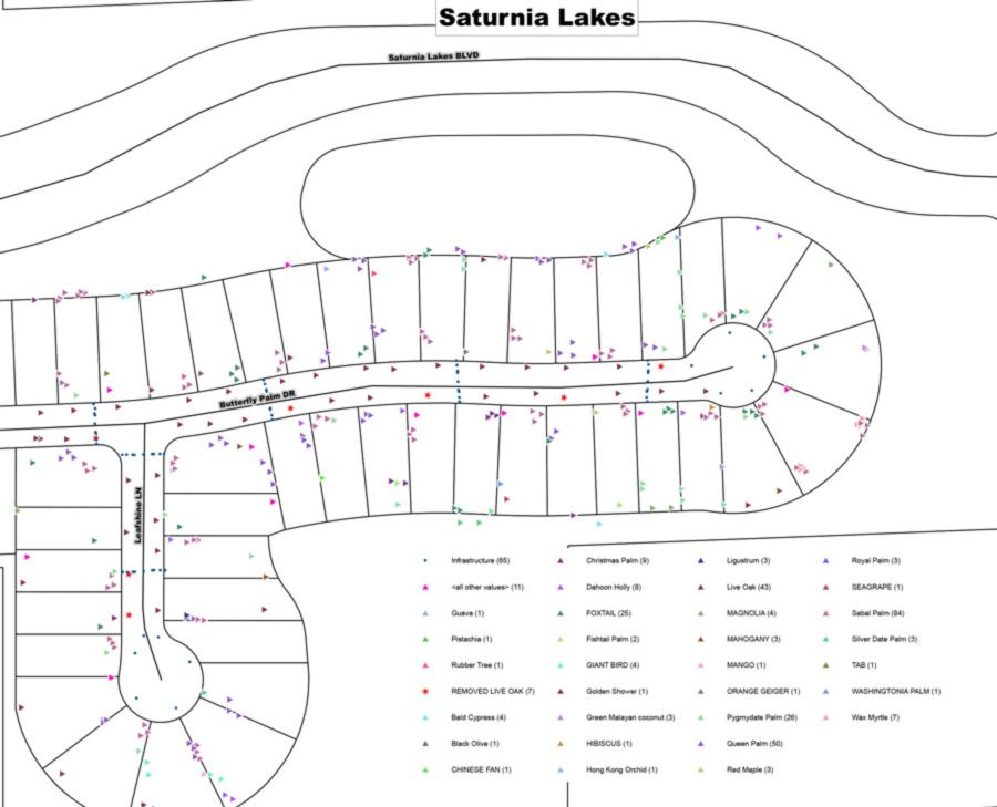
Mapping Tree Inventory: GIS maps precisely catalog tree locations, species, health conditions, and maintenance history for informed decision-making.
Identifying Priority Areas: Overlay tree data with power lines, buildings, and other infrastructure to easily pinpoint trees requiring attention, ensuring safety and preventing outages.
Optimizing Trimming Operations:
Strategic Planning: GIS software analyzes spatial patterns to prioritize trimming schedules and allocate resources efficiently, saving time and money.
Tracking Progress: Track trimming activities in real-time, ensuring completion and identifying any areas requiring follow-up, fostering accountability and transparency.
Enhancing Community Engagement:
Shared Information: Interactive GIS maps inform residents about trimming schedules, tree health, and benefits of urban forestry, promoting understanding and appreciation.
Collecting Feedback: GIS enables communities to collect feedback on tree management, fostering collaboration and data-driven decision-making.
GIS mapping roots itself as an essential tool for managing urban forests effectively. By visualizing data and streamlining operations, it helps communities maintain healthy trees, mitigate risks, and foster a thriving urban ecosystem.
Mongoven Mapping & GIS Services have mapped irrigation and lighting systems as well as recorded other relevant utilities based upon the specific project.