
FLORIDA GOLF COURSE CONSTRUCTION MAPS
Maps can display information in labels, spreadsheets, symbology or some combination.
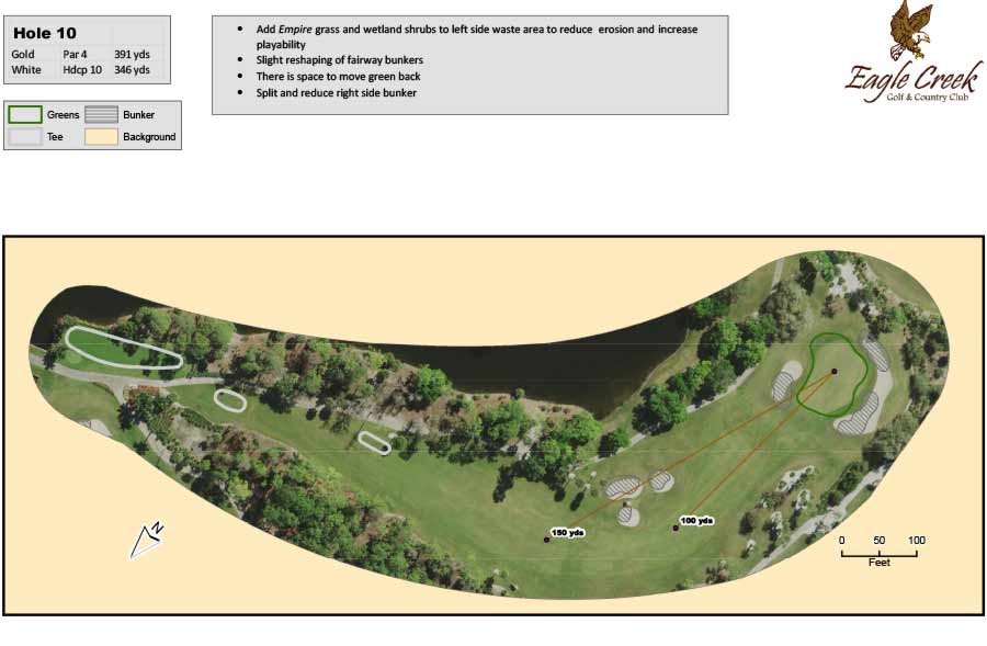
Prior to construction we have provided Master Plan documents which included actual and conceptual plans for golf holes.
FLORIDA GOLF COURSE CONSTRUCTION MAPS
Construction related maps include documenting and providing data prior to construction as well as as-built maps which fulfill contract obligations and show owners where utilities are after the construction is completed.
- Ground penetrating radar can be used to locate utilities and then we map them with GPS equipment.
- Contour mapping for planning/design purposes as well as estimating dirt needs for a job.
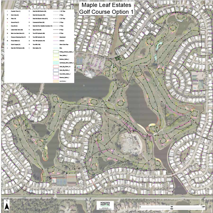
During construction mapping of all utilities including irrigation components, irrigation main line, irrigation wire path, drainage components, drainage pipe, other utilities and all area types. The number of components and linear measurements of pipe can be generated and/or displayed.
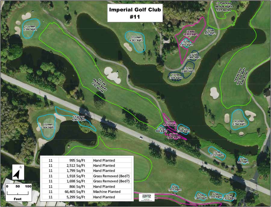
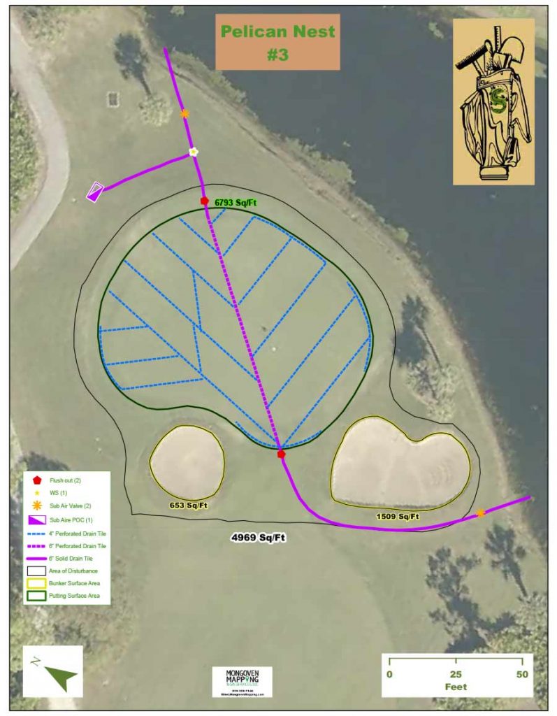
Other maps can be provided that verify areas and firm up budgets and area totals during the contract negotiation phase of a project. These can include areas of disruption; measurements/maps showing the difference between the proposed and existing conditions; locating the center point on putting surfaces which serves as a construction starting point.
Areas can be divided by a variety of variables including:
- Putting surface; fairway; tee tops; etc.
- Bermuda grass variety; pine straw; zoysia grass; etc.
- Machine planted; hand planted; seeded; sodded; hydroseeded; etc.